Calgary to Waterton National Park via Kananaskis Highway 40 Day Trip
Total Duration: 1 day
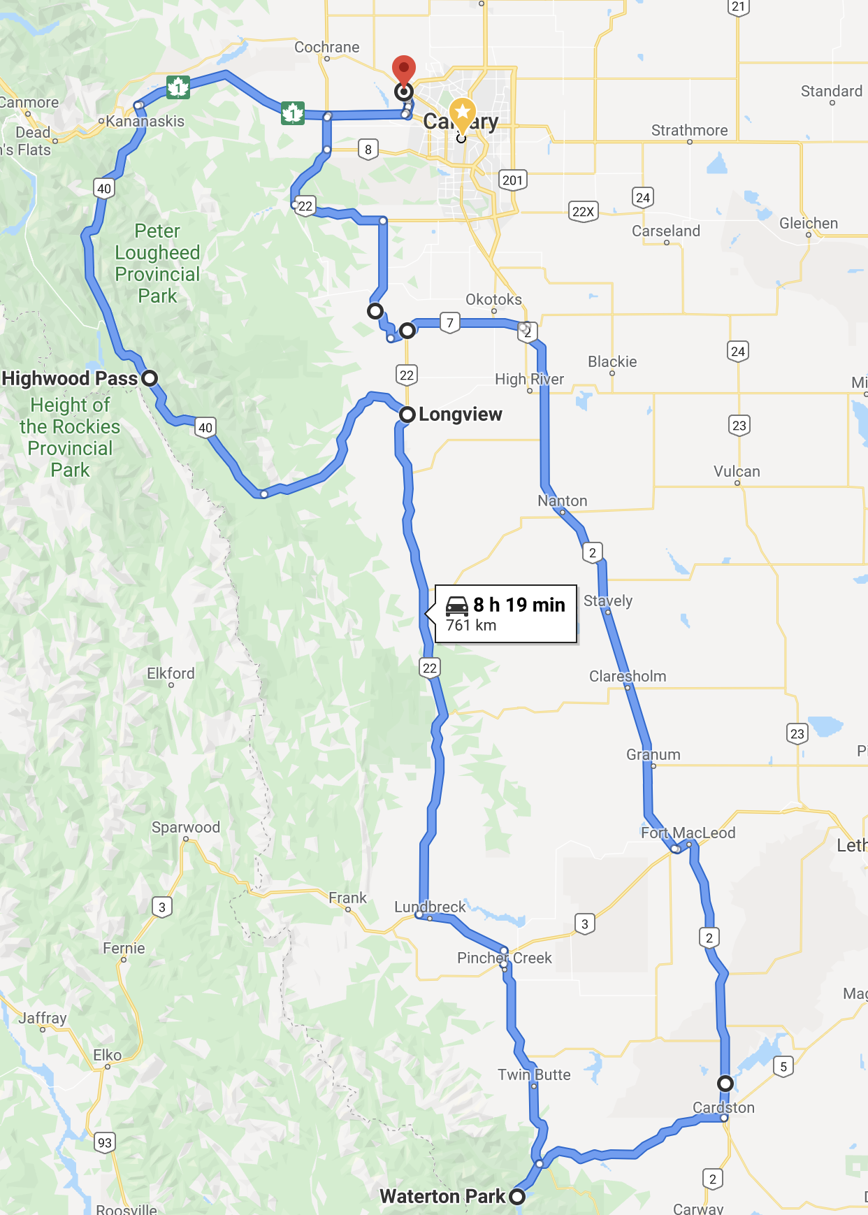
Total Distance Traveled: 761 km
Description: This is a great ride from Calgary. Pick a clear sunny day, pack your park pass, a lunch and go.
| Day | Destination | Distance (Km) | Notes |
| 1 | Highwood Pass | 131 | Highest elevation (2206 m) point on a paved road in Canada. |
| 2 | Waterton National Park | 271 | Quiet little lake town with amazing mountain views all around. |
| 5 | Calgary | 358 | A bit of a drone on hwy 2 on the way back but you make good time. |
| Total | 760 |
Route Map: Click on image to see in Google Maps

